Camp1 and the Hike to the FallsSince I had decided to try a little (unsuccessful) fishing that morning at Summerdale, I wasn't on the road until 11:00 a.m. on Friday. It took about an hour to get back thru the Valley and onto 120 out the Northern Side into the Stanislaus National Forest. I had originally planned on going all the way out to Lumsden campground, but after I got into the forest I decided that the best thing to do was scout campsites as soon as possible. Summerdale (and the Yosemite Valley) are at about 4000 ft (Glacier Point is 7200ft). If I drove to Lumsden I would have dropped all the way down to 1200 ft ... and the trees would be gone and it would be hot. 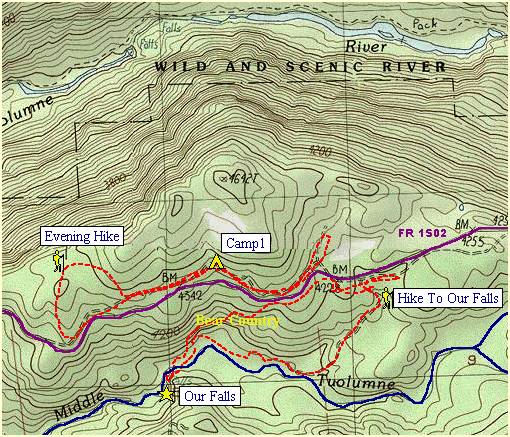
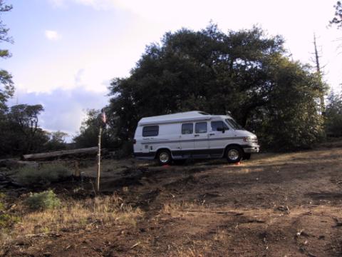
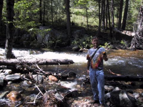
So after about 20 minutes on a secondary road off the main (120) Highway, I turned onto a paved forest road (1S02) at Mather and continued about 10 miles east, to a spot near Abernathy Meadow. There I turned off the paved road and camped about 1/4 mi in on a dirt Forest Service Road at the spot labelled Camp1 on the above map. Only a few cars used the paved (purple) road during the day, and I felt good and isolated camping that night. By the time I got there and settled on the site, made camp and gathered firewood, I had a little time left over for a brief evening walk. This being my first chance to try the GPS (Garmin 60CS), I ascertained that there was a small hiltop 1/4 mile away from which I *should* be able to see most of the surrounding ridge lines. Following the GPS I went around then up the hill and sure enough, in the distance I could see the ridge lines to the South and the North. Even from where I camped I could hear the water rushing thru the valley(s). After walking back to the Van I continued to the east to a little meadow. As I camped that night, I reviewed the Topo maps and GPS information and came to the conclusion the water I was hearing was not from the Greater Tuolumne River (1 mi and 3000 ft elevation away) but rather from a small Waterfall on the Middle Fork of the Tuolumne, which was less than 1/2 mile away and directly south of me. So I decided I would hike down to the waterfall the next day. The next morning I woke up and took a shower! That's right. Right there on that hilltop I took a nice heated shower in the Van. Ahhhhh just right before an adventurous hike. Then I moved the Van about a mile to the East where there was a marked dirt road that led down to the river. Below is a photo of me after I have hiked about 1/2 mile down to the river. From here I had to hike about another 1/2 mil cross country, down the river to the waterfall. So with GPS in hand I snaked my way. At one or two places I had to climb 100 ft or so back up the hillside to get around rock crevices. It was a relatively easy nice hike down to the Falls, even without a path.
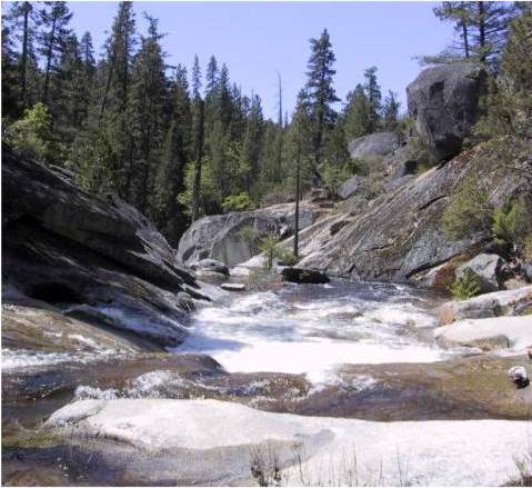
I was very pleased to be rewarded with my own private waterfall. As I was making my way up the hill, I was seeing all kinds of recent animal tracks. I had started to learn about animal tracks on my trip to Sequoia. So I know the difference between cat and canine tracks and can identify most easy signs I see. As I was making my way up this hill, I started noticing some very very fresh bear tracks. Good sized ones. Like 5-6 inch paws. Over 200 lbs. Hmmmmmmm.. It had just rained two nights before so these were particularly FRESH. And to my eye, that just made them look BIGGER. Hmmmmmmmm..... "Hey Bear!" It wasn't much longer when, about 1/2 way up the hill, in the thickest part of the heavy forest, the path I was on crossed near the base of a tree ... and at the base of the tree was a BEAR BED!! He/she had cleared and arranged the pine needles to make a nice cool spot at the base of the tree. ... a 6 foot in diameter cool spot! Yikes! At this point I pretty much decided to go straight up the hill and forego any more animal trails, switchbacks or not! BTW, for the record, I don't actually want to SEE a bear! I was glad to get out of the thickets and back onto the road. When I got back to the Van (about 2:00) I had some lunch and I took the opportunity to rinse off again (after sweating quite a bit on the way out of the valley :-). So by the time I started hunting for a second camp, I was all refreshed and laughing at the escapade. Continue onto the next page of my Yosemite Trip .. |
