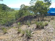
Survey2 - Early experimental charting resultsOn Friday I gathered the data that the boys had collected so far, doing an elevation survey with little more than a compass, level, tape measure, and some string. This album places that survey in context, and provides some initial examples of rendering it, and the 3D design process, in Google Sketchup and Google Earth.
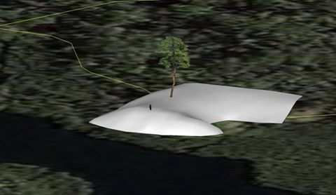
3 people like this album ... Patrick, real nice! ... Tell Chovar I said High! ... Amazing isn't it! Skipping from MBE, to the Computer, the Rhapsody, and to the earth! ... Looks like you're having way too much fun with your computer... are you getting enough vitamin D? Yes Bill Harned, Dana, it's great fun! I've always like to conceptualize things, always wanted to build a place ... this is the culmination of a lot of dreams and skillsets, and I'm gonna take it real slow :-) LOL, uhm, it's pretty obvious isn' it Dana Paredes, I get wrapped up in the puter, always have, but there's a physical aspect to this that's way cool too, and I've always believed in thinking designs through before proceeding to implementation ... lol, I may not be getting enough Vitamin D today, but will be tromping around on the property this week, in the sun, and will make up for it! ... Patrick, don't know Dana but she sounds cool. Happy your into the DYI life style, it makes for your own heaven, your own creation. Bueno Surete! ... BTW, you should write a scripture of this adventure for other followers. A smooth 3D rendering of the property with an example tree and "Jane", a human (the small figure at the front of the property). The actual tree is a nisporo that is just about that high, and looks similar, in that location. The whole model has been geolocated in Google Earth to within a few feet, and any models I end up creating will be exportable, and even visible to others, in Google Earth! As I design structures, docks, buildings, septic/electrical system using Google Sketchup, I will give the plans to Isreal and the workers directly from the program, placed relative to the grid we have created. It's a great tool, and will serve as a reference for design and implementation decisions going forward.
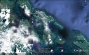
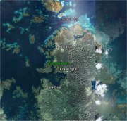
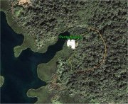
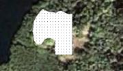
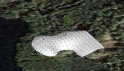
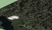
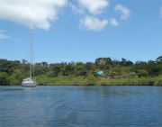
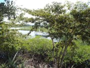
An overview GE shot showing Isla Popa in relationshipt to the town of Bocas Del Toro, Panama. The north end of Isla Popa, showing the well known landmark of Crawl Key, and the villages of Popa Uno and Popa Dos. I jokingly refer to Punta Nisporo, my property, as Popa Uno y Media (Popa One and a Half). Note the large bay just north of Popa Dos, and the smaller bay at the top of that. Punta Nisporo is on the finger baylet in the northeast corner of that bay. ... Large bay north of Popa Dos I think. Oops correctamundo! Photo from GE Showing the finger bay, the property boundary (yellow line), and the white area that has been surveyed so far. After 5 days of work, the boys have measured about 250 points ... about 40,000 sqare feet ... or about 1 of the 12.5 acres on the property .. There's all kinds of things that can be done. Here we show the terrain with the points the boys measured. We could also have topo lines, etc. Note that all the green surrounding the mound and curve of terrain is a protected mangrove wetland, a few feet deep. The water actually comes up to the white outline you can see. One more 3D rendering showing that which we have surveyed, along with the property boundary again, in yellow, from a perspective. I find that this kind of a view, and the ability to rotate and manipulate it in Sketchup, is a great way to think about the land. I hope to plot most of the major trees and areas of certain kinds of growth, water flow, etc. There is already one freshwater spring on the property ... there are probably others ... along with a lot of biodiversity that I'd like to understand, and protect, as well as building and possibly living on the land. Photo of Rhapsody at anchor, inner baylet, Punta Nisporo, facing the property, the blue tent, "Casa Chovar", visible .. As I was lookin at pictures, I remembered that I had a detailed 3-D model of Rhapsody in another program ... TurboCad, so I spent the best part of a day figuring out how to export it into Google Sketchup. In this picture, the model of Rhapsody has been added to the model of the property. LOL, I also have soundings for the baylet, made one day in the dinghy with a handheld sonar, that I could use to model the bottom of the bay! The dimensions of the model of Rhapsody are perfectly in scale, the two programs actually talking pretty nicely. The problems had more to do with rendering surfaces, and exporting complex detail out of the TurboCad drawing which had a huge number of flaws in it. I am using the model of Rhapsody to design a new Bimini and Dodger ... don't know if I'll continue that in Sketchup or Turbocad .... Nonetheless, here's a model of Rhapsody, made for an entirely different purpose, sitting in the model of the property based on data that the guys are getting with sticks and string. Pretty impressive lol .... ... You said the edge of the white was the water line, land, not boat. Does the land truly extend beyond the property line on the water side or am I misconstruing something? When looking from the hill towards the baylet, in real life, you cannot make out Rhapsody in that particular configuration .. Casa Chovar to the right, the baylet out there too. In this rendering, Jane would be seeing pretty much what I showed in the last photo, the bushes and Casa Chovar hiding the view of Rhapsody. It will be cool to add the bushes and structures to be able to model sight lines. In Google Earth I can even slide a slider and watch the scene change from morning to day to night, and the lighting changes according to the time of day. That can be handy to judge things like where the shadows of trees will be, for instance, in choosing the best locations for solar panels, plants of certain types, and naturally shaded structures for humans. A peek of Rhapsody thru the trees .... |
