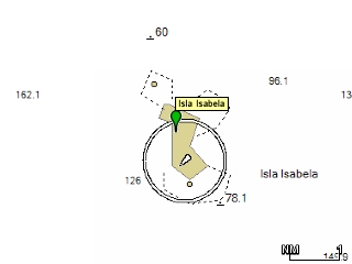
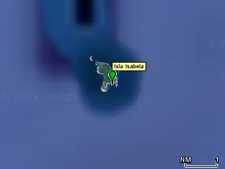
More Chart Discrepancies :-(As we were approaching Isabela, I once again had cause to be dismayed and disappointed by the usefulness of the Raymarine Navionics and Garmin BlueCharts.. At issue is whether you can count on the charts when conditions are not perfect, i.e. when you really need them. We approached Isla Isabela in the early morning. We could see it from perhaps six miles away, so we knew where it was. As we pulled to within a mile of it, however, I noticed, once again, the discrepancy between the charts and the reality. (Ed Note: Since then I have determined that the Navionics/BlueChartsw are uniformly misregistered for the entire Pacific Mexican Coast). This discrepency can probably be best shown by comparing the images from Google Earth, which line up nearly perfectly with our actual GPS position, with the BlueChart for the same position. On the left below is an image showing the BlueChart for our approach and arrival at Isla Isabella. Notice that, according to the chart, we anchored on land! The image on the right shows the same track and waypoints plotted in Google Earth, and not only shows much more detail (including the bay itself), but is more accuratly "registered" (it lines up with the actual GPS coordinates better). So, imagine now, that instead of a nice sunny morning, it's a darky, rainy, night, there's no moon, and it's an emergency (perhaps the boat is taking on water), you have no radar and you are forced to rely on the charts to find your way into an unknown harbor. You'd never get there with the Garmin/Raymarine products! In this case, you'd be trying to set your anchor out in the open ocean, about 1/2 mile from the island. And although the chart plotter has a function to adjust the offset of the chart (really just a kludge to get things to line up), it is limited to about 1/2 mile of correction, so there was no way I could get the chart to line up. Thus, once again, I found myself with a series of useless waypoints on a very pretty, and very expensive, but not very helpful chart plotter. Remember that on our entrance to Altata and Mazatlan, the same kinds of discrepancies occurred, and yet, that with Google Earth, the tracks were much more accurate vis-a-vis the actual location of things. It is surprising that Google Earth, which is free, would have such better cartography that these Navionics charts, for which I paid several hundred dollars each. And in this day and age of GPS accuracy to a few dozen feet, that boaters in general just put up with this level of quality is sad. OK. Enough said. Now back to the good stuff! |
![Garmin Bluecharts were [br]a little better, but not much](../files/2007-12-08b/IMG_6640.jpg)

